Flood Vulnerability Mapping
(Morogoro Municipal)
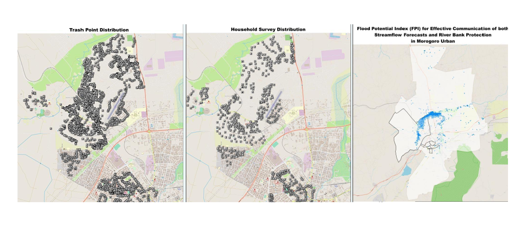
SMCoSE YouthMappers, in collaboration with GeoTE, conducted a community mapping initiative to identify flood-vulnerable areas in Morogoro Municipality. The project addressed the persistent issue of urban flooding, largely caused by clogged drainage systems due to solid waste deposition. Focusing on flood-affected zones from the past five years, the fieldwork aimed to map trash collection points as a key step toward data-driven solutions. Over 3,000 trash points were recorded, providing a valuable baseline dataset that, when integrated with drainage system maps, can support the Morogoro Urban Planning Unit in developing effective flood mitigation strategies.
This Projects Achievements:
- 3000+ Trash Points in Morogoro Municipal
- 12 variables
- 20 Data enumerators (Youth)
- Flood risk Map in Morogoro Municipal